Mapping Micro-Scale Heat Risk in New York City: A Fine-Grained Index Incorporating Adaptive Capacity
Mapping Micro-Scale Heat Risk in New York City: A Fine-Grained Index Incorporating Adaptive Capacity
Using the Google Earth Engine (GEE) JavaScript API to Examine Wildfire Severity
Team Member:
Miaojing(Mina) Wei
Affiliation:
Graduate School of Architecture, Planning and Preservation, Columbia University
Course:
Graduate Thesis
Professor:
Anthony Vanky
Team Members:
Daoxin Chen, Hongqian Li, Miaojing Wei, Zihao Zhang
Affiliation:
GSAPP Urban Planning Spring Studio
Course:
Advanced Spatial Analysis Spring 24
Introduction:
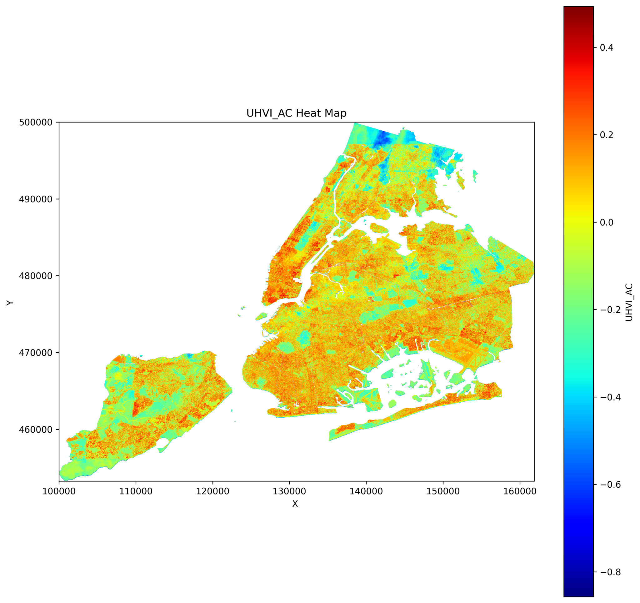
Developed a 30-meter resolution Urban Heat Risk Index (UHRI) by integrating Landsat-derived land surface temperature (LST), NDVI, LiDAR elevation, dasymetric population mapping, and Citi Bike trip data. This micro-grid (30×30 m) assessment framework enabled block-level analysis, uncovering spatial disparities that are often masked in traditional census-tract-based Heat Vulnerability Index (HVI) models. A key innovation involved incorporating human mobility data into the adaptive capacity dimension, capturing real-world heat exposure based on commuter behavior. Using spatial-statistical methods, I modeled the interaction between exposure, vulnerability, and adaptive capacity through a weighted composite index. The analysis revealed patterns of environmental injustice, where heat-vulnerable populations face heightened exposure due to limited mobility and infrastructure. Based on these findings, I proposed spatially targeted interventions, including cool corridors and reflective pavements, to mitigate urban heat risk in underserved areas.
Project Deliverables:
Contact
please contact me at my email address
Email: m.wei2@columbia.edu